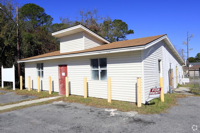
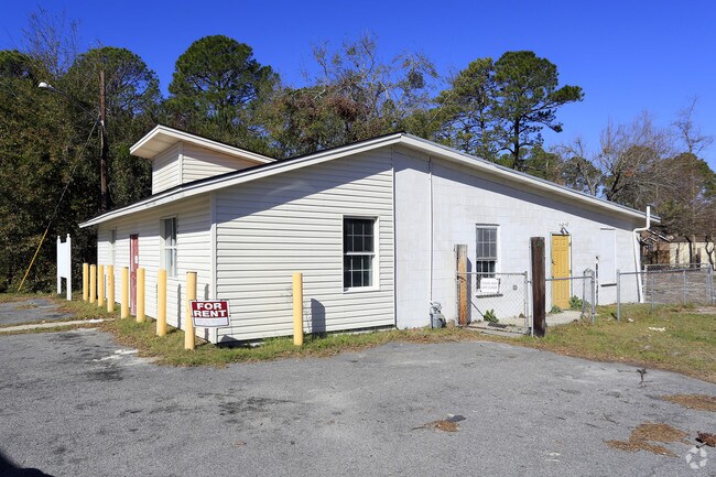
Property Record
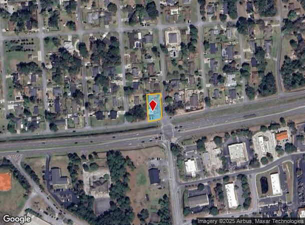
4802 Kim St, Savannah, GA 31410
NEARBY LISTINGS FOR SALE OR LEASE
Property Detail
4802 Kim St
Savannah, GA
Grays Sub
1012913007
LOT 218A, GRAY'S SUB
Officebuilding
Chatham
X
Georgia
45053C0550D
218
2024
0.35 AC
2025
Outer Islands
011107
Savannah
1,800 SF
DEMOGRAPHICS near 4802 Kim St
1 Mile
3 Mile
5 Mile
2024 Total Population
5,195
21,028
74,313
2029 Population
5,351
21,708
76,753
Pop Growth 2024-2029
+ 3.00%
+ 3.23%
+ 3.28%
Average Age
43
42
41
2024 Total Households
2,329
8,935
30,849
HH Growth 2024-2029
+ 3.13%
+ 3.40%
+ 3.50%
Median Household Inc
$76,082
$69,548
$64,269
Avg Household Size
2.20
2.30
2.30
2024 Avg HH Vehicles
2.00
2.00
2.00
Median Home Value
$323,832
$335,421
$279,056
Median Year Built
1994
1984
1973
Nearby Places
Map Layers
Map Styles
 Street
 Aerial
- Restaurants
- Banks
- Shops
- Fitness
- Groceries
PUBLIC TRANSPORTATION
AIRPORT
Savannah/Hilton Head International
DRIVE
WALK
Distance
Savannah/Hilton Head International
27 min
16.0 mi
Hilton Head
DRIVE
WALK
Distance
Hilton Head
68 min
43.5 mi
Freight Ports
Georgia Ports - Savannah
DRIVE
WALK
Distance
Georgia Ports - Savannah
20 min
11.8 mi
SALE & LEASE HISTORY
LISTING DATE
SALE/LEASE

Feb 16, 2017
For Lease
Nearby Properties
Address
Land Use
TOTAL SIZE
Lot Size
Zoning
Address
Land Use
TOTAL SIZE
Lot Size
Zoning
26,388 SF
27.95 AC
PUD
Address
Land Use
TOTAL SIZE
Lot Size
Zoning
9,303 SF
9.84 AC
PUDM
Address
Land Use
TOTAL SIZE
Lot Size
Zoning
8,112 SF
17.89 AC
R1
Address
Land Use
TOTAL SIZE
Lot Size
Zoning
5,760 SF
20.03 AC
R1
Address
Land Use
TOTAL SIZE
Lot Size
Zoning
92,763 SF
32.07 AC
RA
Address
Land Use
TOTAL SIZE
Lot Size
Zoning
20,668 SF
15.60 AC
R1
Address
Land Use
TOTAL SIZE
Lot Size
Zoning
11,240 SF
9.35 AC
RM25
Address
Land Use
TOTAL SIZE
Lot Size
Zoning
17,324 SF
724.70 AC
I-H
Address
Land Use
TOTAL SIZE
Lot Size
Zoning
20,630 SF
8.81 AC
PUDM
Address
Land Use
TOTAL SIZE
Lot Size
Zoning
14,832 SF
9.25 AC
RM25
Address
Land Use
TOTAL SIZE
Lot Size
Zoning
6,960 SF
9.06 AC
C1
Address
Land Use
TOTAL SIZE
Lot Size
Zoning
48,810 SF
6.67 AC
RM25
Address
Land Use
TOTAL SIZE
Lot Size
Zoning
11,376 SF
8.40 AC
RM25
Address
Land Use
TOTAL SIZE
Lot Size
Zoning
29.35 AC
RA-BN
Address
Land Use
TOTAL SIZE
Lot Size
Zoning
7,841 SF
5.99 AC
R1
Address
Land Use
TOTAL SIZE
Lot Size
Zoning
42,658 SF
10.13 AC
PBC
Address
Land Use
TOTAL SIZE
Lot Size
Zoning
70,246 SF
6.09 AC
R1
Address
Land Use
TOTAL SIZE
Lot Size
Zoning
15,250 SF
10.79 AC
PUDIS
Address
Land Use
TOTAL SIZE
Lot Size
Zoning
13,229 SF
20.64 AC
TB
Address
Land Use
TOTAL SIZE
Lot Size
Zoning
840 SF
51.68 AC
PUDM
Address
Land Use
TOTAL SIZE
Lot Size
Zoning
4,478 SF
4.81 AC
I-H
Address
Land Use
TOTAL SIZE
Lot Size
Zoning
90,003 SF
1.80 AC
Address
Land Use
TOTAL SIZE
Lot Size
Zoning
41,353 SF
5.23 AC
PBC
Address
Land Use
TOTAL SIZE
Lot Size
Zoning
31,522 SF
6.03 AC
PR3-16
Address
Land Use
TOTAL SIZE
Lot Size
Zoning
29,242 SF
5.38 AC
TB
Address
Land Use
TOTAL SIZE
Lot Size
Zoning
14,601 SF
4.15 AC
RA-BN
Address
Land Use
TOTAL SIZE
Lot Size
Zoning
9,384 SF
10.06 AC
Address
Land Use
TOTAL SIZE
Lot Size
Zoning
3,828 SF
119.20 AC
R1
Address
Land Use
TOTAL SIZE
Lot Size
Zoning
2,400 SF
6.43 AC
PBC
Address
Land Use
TOTAL SIZE
Lot Size
Zoning
97,321 SF
13.56 AC
PBC
The World's #1 Commercial Real Estate Marketplace
Connect with us
© 2025 CoStar Group
The information above has been obtained from sources believed reliable. While we do not doubt its accuracy we have not verified it and make no guarantee, warranty or representation about it. It is your responsibility to independently confirm its accuracy and completeness. Any projections, opinions, assumptions, or estimates used are for example only and do not represent the current or future performance of the property. The value of this transaction to you depends on tax and other factors which should be evaluated by your tax, financial, and legal advisors. You and your advisors should conduct a careful, independent investigation of the property to determine to your satisfaction the suitability of the property for your needs.